4.1 Data zones
4.1.1 The figures in this publication are based on the projected
populations of ‘data zones’. Data zones are the
standard small area geography used by the Scottish Government. In
general they have populations of between 500 and 1,000 residents.
Data zone boundaries do not exactly match the National Park and SDP area boundaries and so, for the purpose of the projections,
data zones are included or excluded based on the ‘population
weighted centroid’. The use of data zone centroids is a standard approach for assigning the population of a small geographical area to a larger area if the small area does not wholly fit within the boundaries of the larger area or lies across the border of two larger areas. The centroid is not a representation of the geographical centre of the data zone, but rather a representation of the population weighted centre or, put more simply, the population “centre of gravity” of the area. In this publication, a data zone is allocated to the National Park if the population weighted centroid lies within the park boundary.
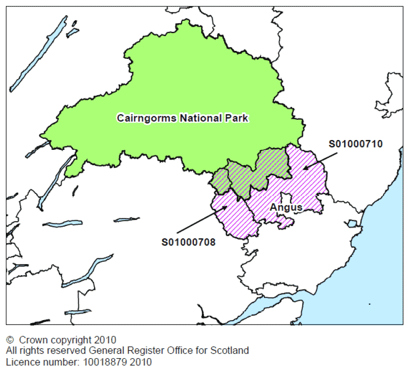
4.1.2 For example, there are two data zones in Angus council area (S01000708 and S01000710) that overlap the boundary of Cairngorms National Park. The population weighted centroid of both data zones lies outside the National Park, and they have therefore been assigned to the TAYplan area rather than to Cairngorms National Park (see Map 3). Thus in practice, the population of the whole of Angus council area is included in the projections for TAYplan SDP area. Because the population of the area of overlap is very small, this makes a negligible difference to the projections. Similar circumstances apply to the small part of Perth & Kinross council area that lies within Loch Lomond and the Trossachs National Park, and a small part of Aberdeenshire council area that lies within the Cairngorms National Park.
Map 3: Data zones in Cairngorms National Park and Angus council area
4.2 National Park boundaries
4.2.1 Maps 4 and 5 show the boundaries of the two National Park areas (rather than the data zones used in this publication, which are listed in Annex A). Maps comparing the geographical and data zone boundaries, which highlight the areas included and excluded from each area, are available at http://www.nrscotland.gov.uk/statistics-and-data/statistics/statistics-by-theme/housholds/household-projections/2008-based-sdp-areas-and-national-parks/list-of-maps
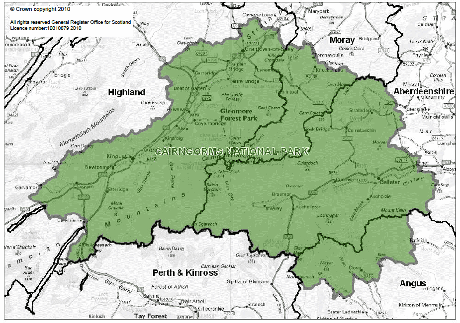
Map 4: The boundaries of CNP and the constituent local authorities
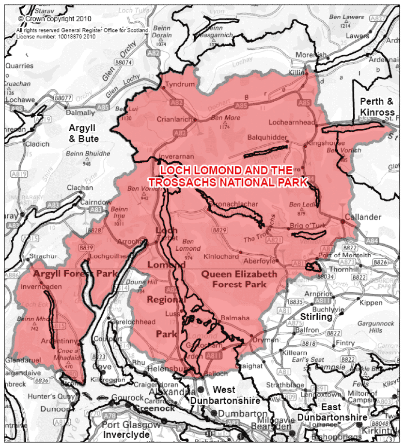
Map 5: The boundaries of LLTNP and the constituent local authorities
4.3 SDP area boundaries
4.3.1 The data zone boundaries of the SDP areas are shown in Maps 6 to 9. The maps show the data zones used to calculate the population projections rather than the actual SDP area. A list of the data zones used to split Aberdeenshire, West Dunbartonshire and Fife into the appropriate SDP areas for these projections can be found in Annex B.
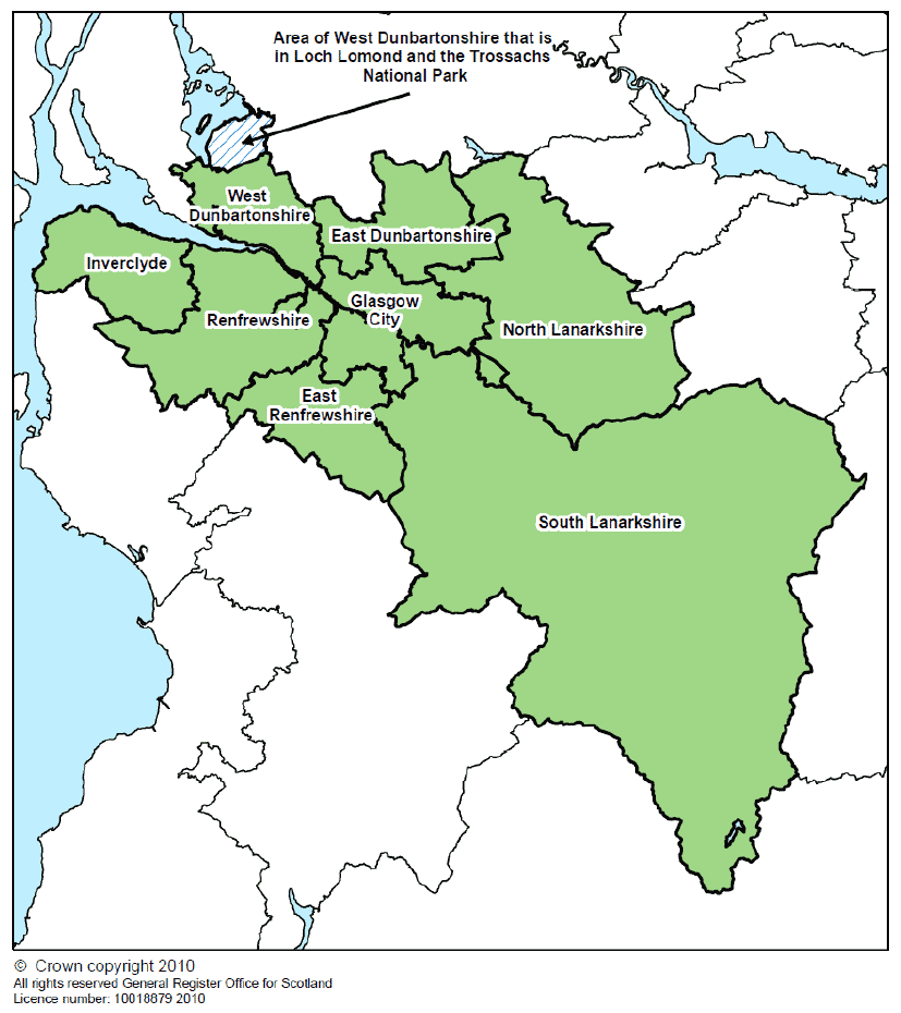
Map 6: The location of Glasgow & Clyde Valley SDP area and the constituent local authorities
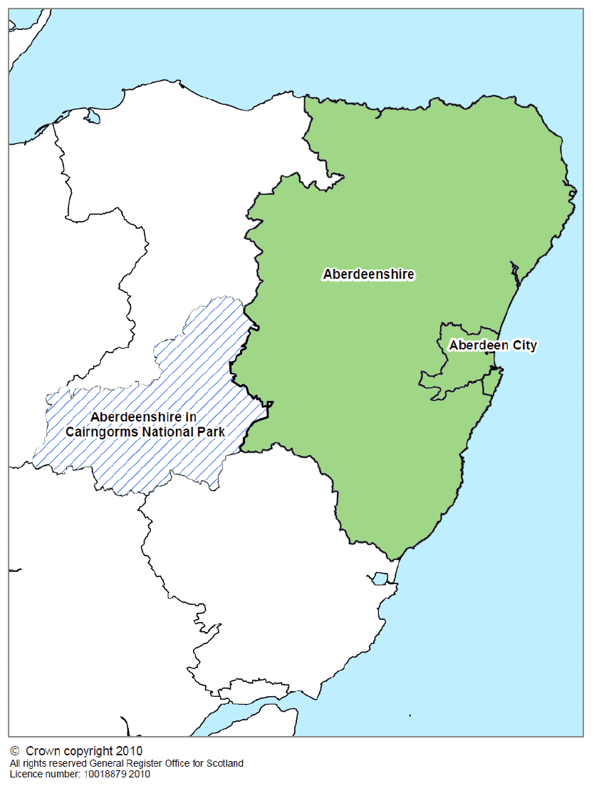
Map 7: The location of Aberdeen City & Shire SDP area and the constituent local authorities
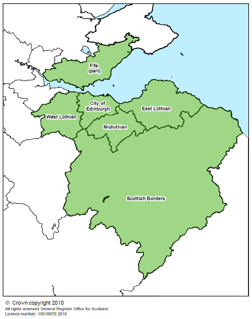
Map 8: The location of SESplan SDP area and the constituent local authorities
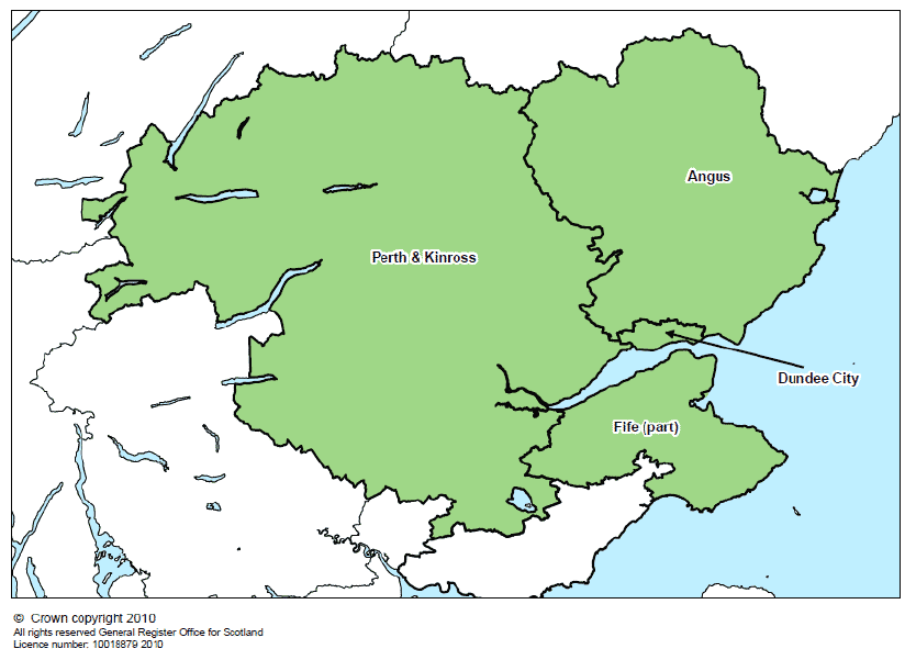
Map 9: The location of TAYplan SDP area and the constituent local authorities